The short version
- Free founding pilot, for a limited number of municipalities: up to 15 culverts and 20 intersections, located, rated and photographed. Survey control set at cost.
- Proven field equipment: a Skadi® Gold GNSS receiver with the Skadi Smart Handle™ from Eos Positioning Systems, the Canadian GNSS maker.
- A QGIS map you own, with the source of every number shown, ready for your 588/17 review.
- After the pilot, your crew collects on patrol. We train, check and keep it current.
- Can be paid for from your OCIF or gas tax funding.
What you get
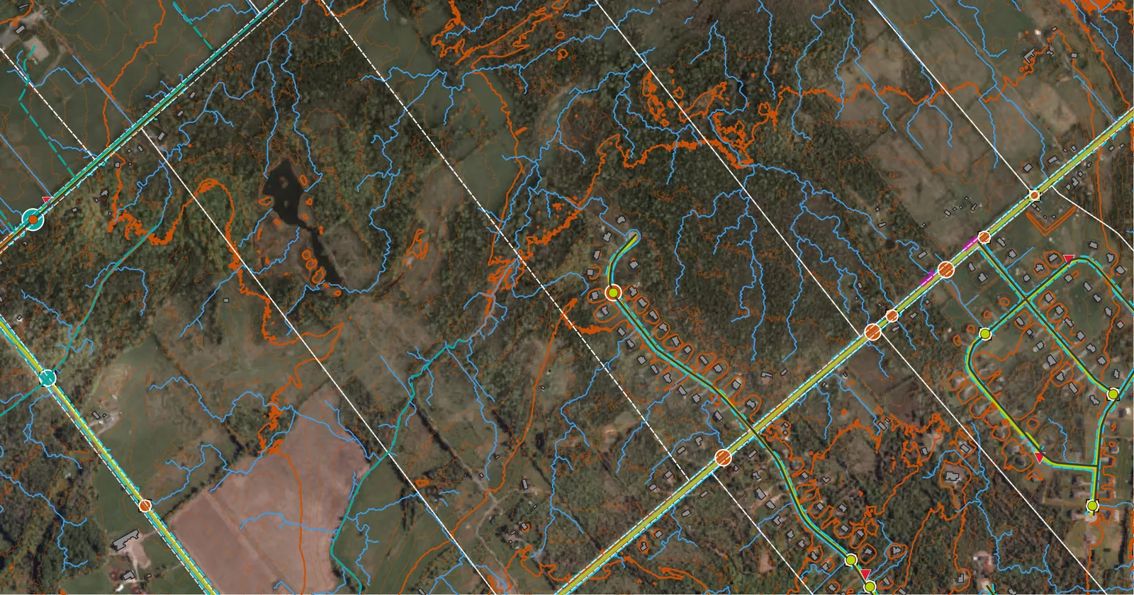
- A desktop GIS map of your roads, ditches and drainage, delivered as a QGIS project you own, in your municipality's coordinate system (UTM or MTM), with a metadata record for every layer: source, date, accuracy and licence.
- Field-verified culverts, starting with a pilot sample: each one visited is located by RTK GNSS, condition-rated and photographed. The rest are mapped from public data as candidate crossings and flagged until someone gets to them.
- Every value tagged by source: measured by us, collected by your staff, municipality-supplied, or missing. You can see what's solid and what still needs a look.
- Survey control points the municipality owns, set and observed by us, tied to NAD83(CSRS) and CGVD2013, with coordinates also given in your municipality's own system and older CGVD28 heights where your drawings use them. Your old data, your contractors and future work all sit on the same ground. Crews can check into them, or set up a base on them for RTK work.
- A check on the public data you rely on: we measure how far the public LiDAR and imagery sit from our control points in your municipality. Where the difference is consistent, we correct it to the control and report what's left. Where it isn't, we report it as found.
- A 5-year storm flag on every crossing visited: a screening check of whether the measured pipe is big enough, for your engineer to confirm. Crossings not yet visited carry the pipe size they would need.
How a pilot works
- A call to set up a meeting about where your plan stands and which roads matter most.
- Sites spread across the whole municipality: up to 15 road culverts, 20 road intersections and 20 open-sky control points, agreed with your public works staff.
- Fieldwork from the shoulder and ditch, with traffic protection and utility locates where needed.
- Delivery: the pilot data in open formats that open in free QGIS, one record sheet per culvert with its 5-year storm flag, a control point register, a public data accuracy note, and a one-page summary for Council.
Free pilots are offered to our first few municipalities while we prove the process and build case studies. After that, engagements are paid work. The culvert and intersection work in a pilot, including the 5-year storm flags, is offered at no cost to the municipality, for up to 15 culverts and 20 intersections. More can be added as paid work. Survey control, up to 20 points, is set at cost: the municipality supplies the materials, and we set and observe the points at cost. The full municipal QGIS project, drainage screening and ongoing upkeep are paid work. We also ask for written permission to work in the road allowance, any culvert or road records you already hold, one staff contact, and permission to share the results as a case study.
After the pilot: your crew collects, we check
- We train your staff on the pilot sites, so everyone rates culverts the same way.
- Your crew logs culverts on regular road patrols, with a GNSS receiver arranged through us and set-choice forms in free QField on a phone. Records come back by cable or file transfer, with no cloud subscription needed. No separate project, no extra trips.
- Every record is checked before it goes into your map, and tagged as collected by your staff.
- We keep the map and the control current: the QGIS project, your 588/17 numbers, and the survey control points, which we set and observe ourselves.
- Need it done faster? We can do the extra sites as paid work.
How the work is done
- Culvert condition is rated on the five-point scale Ontario asset management plans use, Very Good to Very Poor. Each rating comes with what we saw at the inlet, outlet, barrel and road above, how blocked it is, photos, and a recommended action: monitor, clean out, repair or replace, with timing. Structures 3 m and over stay with your bridge inspection engineer, and we flag any we find for OSIM.
- Every position comes with its measured accuracy. Typical RTK is a few centimetres.
- Nothing is dug or cleaned. Buried or flooded inverts are measured down from the top of the pipe and marked as measured, derived or estimated, with sediment depth recorded.
- Proven field equipment. Fieldwork uses a Skadi® Gold GNSS receiver with the Skadi Smart Handle™ from Eos Positioning Systems, the Canadian GNSS maker trusted by municipal and utility crews around the world.
- Control records load straight into your GIS, as open GeoPackage and CSV files, with the datum transformation documented.
- Built to feed what you already have: your asset management plan, your consultant's work and your county or regional GIS. It replaces none of them.
Why it fits a small municipality
- Open-source QGIS, so no licence fees.
- The data stays the municipality's. Open formats, and no software subscription.
- Ready for your annual progress review, due each July 1 under O. Reg. 588/17.
- Keeps your infrastructure funding on track, and can be paid for by it. OCIF and your federal gas tax allocation both require a 588/17 plan with improving condition and risk data, and both allow spending on third-party condition assessments, GIS and staff training. Field-checked, risk-ranked crossings also make stronger applications for programs like climate resilience funding.
Limits
Visual condition ratings, screening-level capacity flags and survey-grade positions only. Not a structural assessment, hydraulic design or engineering assessment, and not a legal survey: nothing here marks or defines a property line.
Status
Now taking a small number of founding pilot municipalities in Ontario, starting in Eastern Ontario. Once those spots are filled, engagements move to paid work.
On the 2027 roadmap, if demand is there: aerial lidar on a DJI Matrice 400 RTK with the Zenmuse L3, for ditch and culvert profiles across the whole road network.
Call to set up a meeting with Trevor
Tell us where you are with the plan. Or call or text 613-219-0288, or email founder@tdoubleai.ca.
Trevor Affleck, A.Sc.T. 25+ years in Ontario construction layout, legal surveys and municipal infrastructure mapping.